Submitted by Jon Reed on
With iOS 10 Apple has given third-party apps access to many of the iPhone's native apps, including Maps. By using extensions, features of third-party apps can be used directly from the Maps app, streamlining tasks like requesting a ride or making a restaurant reservation. Along with Uber and OpenTable, Lyft has quickly updated its app to integrate with Maps. If you are a Lyft user and want to link it to your Maps app, here's how to do it:
- First off, you will need the Lyft app (and an account) to use its extension in Maps. If you don't already have it, download the Lyft app from the App Store. If you already have it, make sure you have the most recent version.
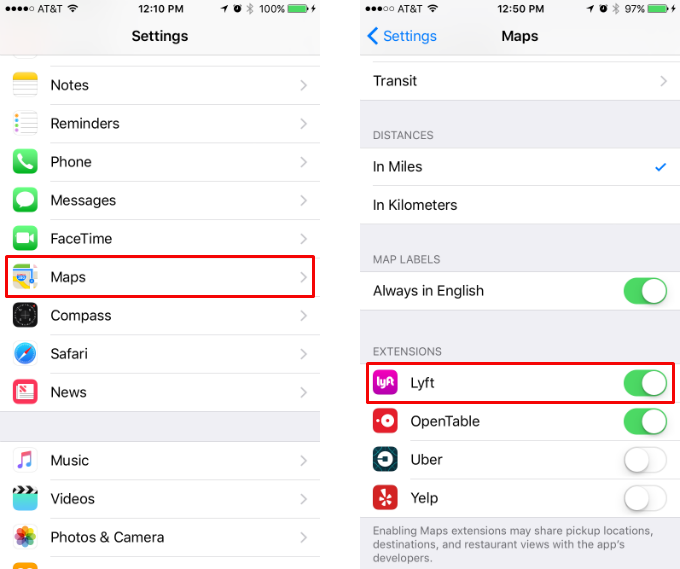
- Head to Settings -> Maps and switch the Lyft toggle to on in the Extensions section.
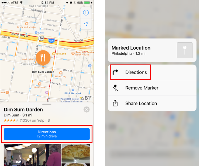
- Open Maps and tap a labeled location that you'd like a ride to. If it is an unlabeled place, such as a street corner, tap and hold until it becomes a marked location. In either case, tap Directions when the info window pops up.
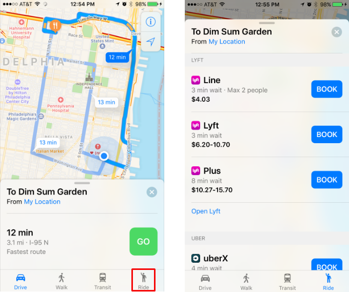
- Tap the Ride button in the bottom right and a list of Lyft options will come up including ride type (Line, Lyft, Plus, etc.), estimated wait times and costs. If you prefer to do this through the Lyft app there is a link to open it at the bottom of the list.
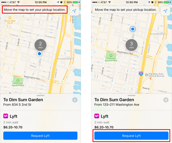
- Select your preferred option with the Book button. Now you will see your location on the map along with a gray circle indicating the estimated wait time. You can change your pickup location by moving the map around (the gray circle will remain centered and will mark your pickup location). Once you are ready, tap the Request button at the bottom and your Lyft will be on its way.
tags:
